Our Footprints
If you are looking for a home away from home, Give us a call. You can get
both, an incredible and relaxing experience while you are on a holiday. Take
a closer look into the destinations we frequent and pick the one for you.
Come Travel with Us
Pick any of our destinations to experience the natural fauna and flora, complemented with modern amenities for a comfortable stay.
Savute-Chobe National Park
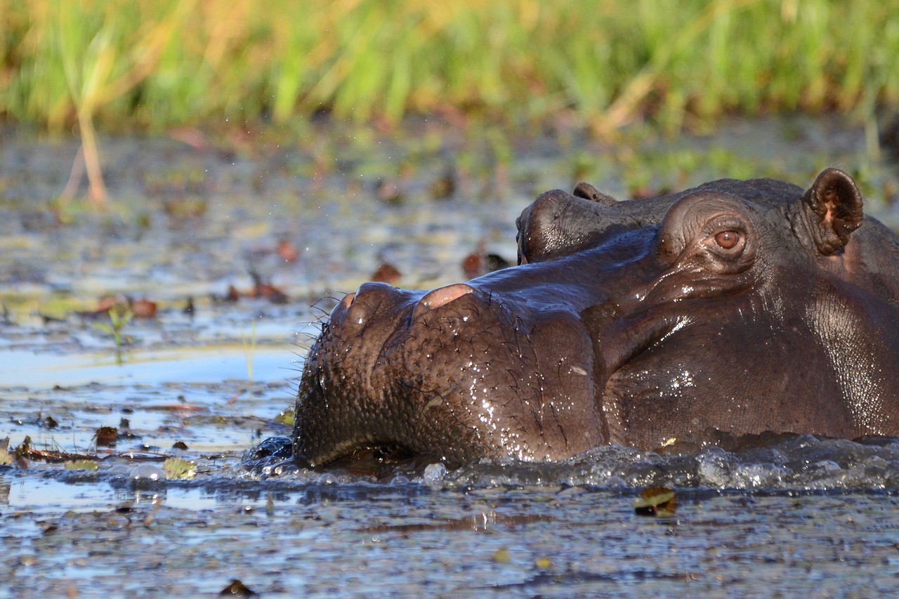
Botswana’s famous Chobe National Park, which includes the Savuti Channel and the natural grandeur of the Linyanti River, is a must-see wildlife attraction. Chobe National Park, which covers about 11,000 km2 (4,247 square miles), was Botswana’s first national park and has Africa’s highest concentration of wildlife. Chobe Savuti Marsh is located in Chobe National Park.
Chobe National Park was proclaimed in 1968 and protects an area of 11,700km2 (4,517 square miles) that was mainly ravaged by big game hunters and commercial logging at the time of its formation.
The Park is located in the northeast of Botswana, falling within the convergence of two major biomes: Kalahari savanna meets broad-leaved and acacia woodland and Zambezi Teak forest.
Running through these beautiful ecosystems is the illustrious Chobe River, with its yawning floodplains and surrounding riparian forest. Chobe has some of the best safari lodges in Africa, with great views of the wildlife, delicious food, and excellent service on a Botswana safari holiday.
The Chobe River rises in Angola as the Kwando (Cuando) River and then disappears into the swamplands of the Linyanti, reemerging as the Chobe River. During winter months, the banks of the Chobe attract the largest population of elephants in the world at around 60 000 – 70 000 individuals.
Add great herds of buffalo, notoriously fearless lion prides, and 468 bird species to date, and you’ve got a playground for nature-lovers that’s second to none. From November to December, herbivores migrate between the Chobe River and the Savuti Marsh in pursuit of fresh grazing grounds.
The Savuti Marsh in Botswana
The Savuti Marsh is an expanse of grasslands in the western region of Chobe National Park. In Botswana’s BaYei dialect, the word Savuti means “unclear,” which is thought to be a reference to the area’s unpredictable water supply, the Savuti Channel.
During the rainy season, the Savuti plains are lush and green. While Bateleur eagles and White-backed vultures circle the skies, large herds of buffalo and zebra can be seen roaming the open plains. Small islands with Illala and Wild date palms are grouped together, providing shady hiding places for predators during the midday sun. During the dry season, many elephants are drawn to three man-made water holes introduced to the Savuti region in 1995.
Central Kalahari Game Reserve
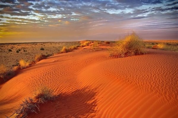
The Central Kalahari Game Reserve is over 42 000 km2 and is one of the biggest game reserves in Africa. Our operation focuses on the northern part in Deception and Passarge Valleys where wildlife is significant for both bird, reptiles, insects and mammals. One of the best parts of the area is that it is remote and far from the crowds. It is best seen in the rainy or green season as we locals call it. Annual rainfall is not high in this semi-arid environment and there is nothing quite like witnessing a big Kalahari storm.
Moremi Game Reserve
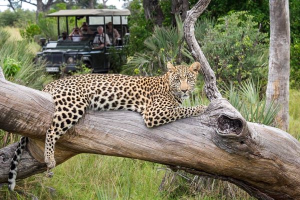
Moremi is considered as one of the real wilderness paradises in Africa. With an unbelievable abundance of African wildlife the safari dream of every traveler comes true.
Geography and climate in the Moremi region
The unique location of the Moremi Game Reserve in the northern Okavango Delta, consisting of a network of five main riverbeds of the Okavango with lakes, reeds, islands and woodland guarantees an unrivaled biodiversity.
The Moremi region has long, hot summers from about November to March and short, cooler winters from June to August, with nighttime temperatures rarely dropping below 10 ° C. In winter, it almost never rains. The main rainfall of the Moremi region is January-March, but the highest water levels are in July – August.
Flora and fauna in the Moremi region
The Moremi region has huge grassland areas, permanent floodplains and large areas of Mopane forests. Elephants are numerous, especially during the dry season. Other game species of the Moremi Game Reserve are buffaloes and giraffes, hippos and crocodiles, predators such as lions, leopards, cheetahs, wild dogs, hyenas, jackals and almost all antelope species of Southern Africa. There are more than 500 bird species as well.
Khwai Concession
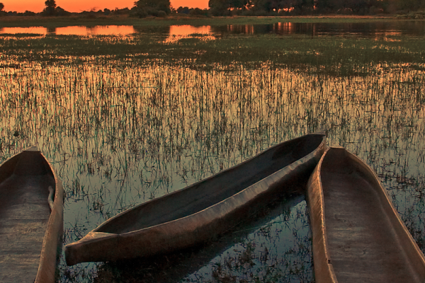
The Khwai River in Botswana is renowned for its outstanding game viewing year-round. Khwai is nestled between Moremi Game Reserve and Chobe National Park, on the edge of Botswana’s Okavango Delta.
Due to this prime location with no fences separating Khwai, Moremi and Chobe an abundance of varied wildlife freely moves through the Khwai River. A good number of large mammals can be seen in the Khwai wildlife area. Khwai is the best place to see African wild dogs in Botswana. Other predators will be lions, leopards, and hyenas. Serval cats, cheetahs, and African wildcats are also found here .The Khwai River is a birding paradise with an amazing diversity of resident migratory species. Bird sightings will include eagles, cranes, egrets, vultures, saddle billed, marabou stock and lilac breasted rollers.
The Khwai River are includes both dry savannah and marsh areas, which supports a diverse range of animals, birds and plants. The river floodplains attract wildlife and birds year around.
Makgadikgadi & Nxai Pans
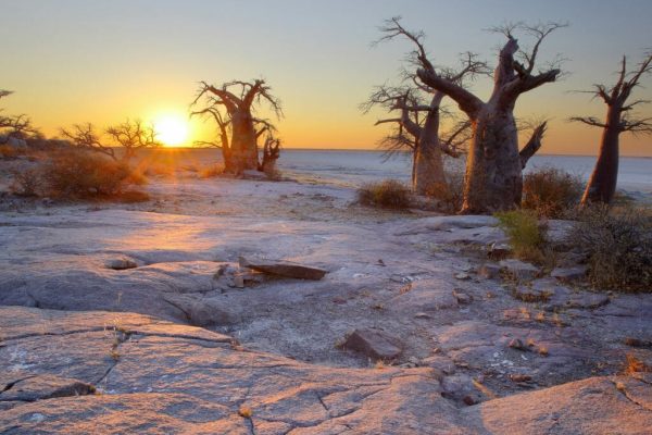
Nxai Pan is a less frequently visited part of Botswana and is noted for desert species such as Springbok, Oryx and Cheetah. It is one of the best places to see Cheetah but is also noted for Black maned Lions, Leopard and Hyena.
The open environment of the pan allows for excellent photography most of which takes place at the water hole. Hours can be spent watching game come and go around the water hole including Kudu, Zebra, Wildebeest, Impala and Springbok. It is also a good place to photograph birdlife adapted to this semi-arid environment including Ostrich and raptors such as Pale Chanting Goshawks.
You can also experience Makgadikgadi Pans, a huge saltpan system, with stunning birding opportunities, a chance to hang out with meerkats and a sleep out under the stars!
Bushmen Experience-Ghanzi
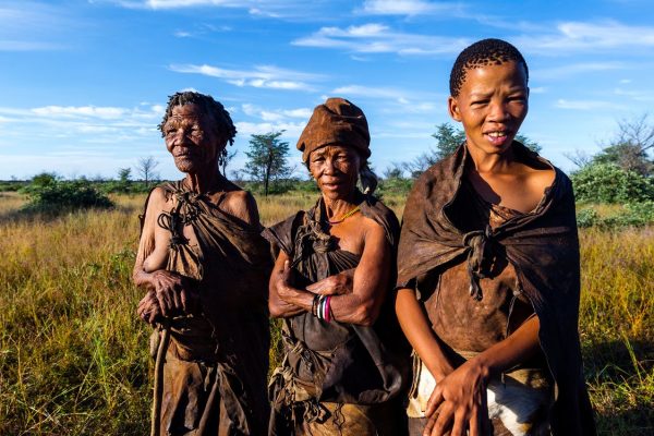
For nearly 50,000 years, the san people also known as the Bushmen have inhibited parts of the south western Africa and lived of the land. A small number of people still reside in Botswana in Ghanzi and are trying to keep their fading traditions alive.
You will have an opportunity to visit this indigenous people and learn a bit about their way of life. You will do a 1-2 hour walk with the bush men and traditional dance after the dark. The walk is led by a group of traditional Bushmen who will show you a number of plants used for various ailments, how they use Ostrich eggs to store water, and how they start fire to cook their dinner. The distance to Ghanzi from Maun is about 3 hours and is easily accessible by road.
Victoria Falls-Zimbabwe
Dr David Livingstone, the Scottish missionary and explorer, is believed to have been the first European to view the Victoria Falls which he did from what is now known as ‘Livingstone Island’ in Zambia.
the only land accessible in the middle of the falls David Livingstone gave the falls the name ‘Victoria Falls’ in honor of his Queen, but the indigenous name of ‘Mosi-oa-Tunya’ literally meaning the ‘Smoke that Thunders’ is also well known. The World Heritage List recognizes both names.
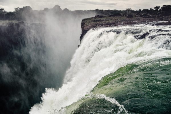
While it is neither the highest nor the widest waterfall in the world, it is claimed to be the largest. This claim is based on a width of 1,708 meters (5,604 ft.) and height of 108 meters (354 ft.), forming the largest sheet of falling water in the world. The falls’ maximum flow rate compares well with that of other major waterfalls for a considerable distance upstream from the falls, the Zambezi flows over a level sheet of basalt, in a shallow valley bounded by low and distant sandstone hills. The river’s course is dotted with numerous tree-covered islands, which increase in number as the river approaches the falls. There are no mountains, escarpments, or deep valleys which might be expected to create a waterfall, only flat plateau extending hundreds of kilometers in all directions.
The falls are formed as the full width of the river plummets in a single vertical drop into a transverse chasm 1708 meters (5604 ft.) wide, carved by its waters along a fracture zone in the basalt plateau. The depth of the chasm, called the First Gorge, varies from 80 meters (260 ft) at its western end to 108 meters (354 ft.) in the center. The only outlet to the First Gorge is 110 meters (360 ft.) wide gap about two-thirds of the way across the width of the falls from the western end, through which the whole volume of the river pours into the Victoria Falls gorges.
There are two islands on the crest of the falls that are large enough to divide the curtain of water even at full flood: Boaruka Island (or Cataract Island) near the western bank and Livingstone Island near the middle the place that David Livingstone first saw the falls from in Zambia. At less than full flood, additional islets divide the curtain of water into separate parallel streams. The main streams are named, in order from Zimbabwe (west) to Zambia (east): Devil’s Cataract (called Leaping Water by some), Main Falls, Rainbow Falls (the highest) and the Eastern Cataract
The Zambezi basin above the falls experiences a rainy season from late November to early April, and a dry season the rest of the year. The river’s annual flood season is February to May with a peak in April The spray from the falls typically rises to a height of over 400 meters (1,300 ft.), and sometimes even twice as high, and is visible from up to 50 km (31 mi) away. At full moon, a “moon bow” can be seen in the spray instead of the usual daylight rainbow. During the flood season, however, it is impossible to see the foot of the falls and most of its face, and the walks along the cliff opposite it are in a constant shower and shrouded in mist. Close to the edge of the cliff, spray shoots upward like inverted rain, especially at Zambia’s Knife-Edge Bridge As the dry season takes effect, the islets on the crest become wider and more numerous, and in September to January up to half of the rocky face of the falls may become dry and the bottom of the First Gorge can be seen along most of its length. At this time it becomes possible (though not necessarily safe) to walk across some stretches of the river at the crest. It is also possible to walk to the bottom of the First Gorge at the Zimbabwean side. The minimum flow, which occurs in November, is around a tenth of the April figure; this variation in flow is greater than that of other major falls, and causes Victoria Falls’ annual average flow rate to be lower than might be expected based on the maximum flow.
Victoria Falls is roughly twice the height of North America’s Niagara Falls and well over twice the width of its Horseshoe Falls. In height and width Victoria Falls is rivalled only by South America, Iguazu Falls.
Swakopmund-Namibia
For nearly 50,000 years, the san people also known as the Bushmen have inhibited parts of the south western Africa and lived of the land. A small number of people still reside in Botswana in Ghanzi and are trying to keep their fading traditions alive.
You will have an opportunity to visit this indigenous people and learn a bit about their way of life. You will do a 1-2 hour walk with the bush men and traditional dance after the dark. The walk is led by a group of traditional Bushmen who will show you a number of plants used for various ailments, how they use Ostrich eggs to store water, and how they start fire to cook their dinner. The distance to Ghanzi from Maun is about 3 hours and is easily accessible by road.
Plan an Unforgettable Experience With Us Today!
We can help you fit your travel and experience within your allotted budget.
Book Your Stay Now
- +267 75834075
